Global Precipitation Maps History&Forecast
Loading...
Global Precipitation Maps History&Forecast
Get current, forecast and historical global precipitation weather maps with a 10 minutes-step via the easy-to-work API.
Features of Global Precipitation Map
URL format and parameters
Use the following URL format and parameters to get weather maps. Please pay attention to the URL example.
https://maps.openweathermap.org/maps/2.0/radar/forecast/{z}/{x}/{y}?appid={API key}&tm={date}Parameters | ||
|---|---|---|
| required | Number of zoom level The minimum value is 3, and the maximum value is 7.You could find information about correlation between zoom levels, X, Y tile coordinate numbers and level scale here |
| required | Number of x tile coordinate. You could find information about correlation between zoom levels, X, Y tile coordinate numbers and level scale here |
| required | Number of y tile coordinate. You could find information about correlation between zoom levels, X, Y tile coordinate numbers and level scale here |
| required | Your unique API key (you can always find it on your account page under the "API key" tab) |
| required | Date and time of (Unix time, UTC), e.g. 1600782000. To get historical or forecast data, please specify the date in your API request. To get current data, please specify the the nearest time in the past rounded up to 10 minutes |
Please pay attention to the points below to avoid possible errors:
https://maps.openweathermap.org/maps/2.0/radar/forecast/6/13/24?&appid={API key}&tm=1600781400You need to insert the generated URL into special plugins.
For example, Leaflet, OpenLayers. You can also use any other apps that support the display of layers. Learn more.
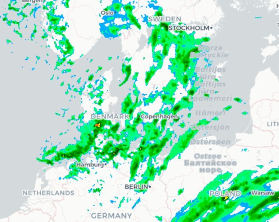
Example of Global Precipitation Map layer
Please find below Global Precipitation Map layer example.
https://maps.openweathermap.org/maps/2.0/radar/forecast/7/4/2?&appid={API key}&tm=1703235600https://maps.openweathermap.org/maps/2.0/radar/forecast/7/4/2?&appid={API key}&tm=1703241000Default palette ranges
Range (dBZ) | Colour | Hex | RGB |
0 to < 7.01 |  |
|
|
7.01 to < 9.83 |  |
|
|
9.83 to < 12.17 |  |
|
|
12.17 to < 15.91 |  |
|
|
15.91 to < 20.02 |  |
|
|
20.02 to < 21.96 |  |
|
|
21.96 to < 23.98 |  |
|
|
23.98 to < 26.01 |  |
|
|
26.01 to < 28 |  |
|
|
28 to < 29.99 |  |
|
|
29.99 to < 31.01 |  |
|
|
31.01 to < 32.01 |  |
|
|
32.01 to < 33 |  |
|
|
33 to < 34 |  |
|
|
34 to < 35.01 |  |
|
|
35.01 to < 36 |  |
|
|
36 to < 37 |  |
|
|
37 to < 39 |  |
|
|
39 to < 40 |  |
|
|
40 to < 41 |  |
|
|
41 to < 42 |  |
|
|
42 to < 45.09 |  |
|
|
45.09 to < 47.91 |  |
|
|
47.91 to < 53.01 |  |
|
|
53.01 to < 59.83 |  |
|
|
59.83 to < 70 |  |
|
|
70 and above |  |
|
|
Libraries to connect weather layers
Open Layers
The following functions are available for the OpenLayers library:
Leaflet
The OpenWeatherMap javascript library is designed to work with the Leaflet mapping service. The current version of the library allows the following:
Using OpenWeatherMap weather tiles with leaflet: PDF